Waiparous Fish Habitat Enhancement Project

Freshwater Conservation Canada Implementer
Project Goals and Objectives
The Waiparous Creek watershed (HUC 10 – 33372 Ha), is designated as critical habitat for the Saskatchewan-Nelson Rivers populations of Westslope Cutthroat Trout (Oncorhynchus clarkii lewisi) and Bull Trout (Salvelinus confluentus), respectively, both listed as Threatened under the federal Species at Risk Act within Alberta. Unnamed Creek is a tributary to Waiparous Creek and contains both Westslope Cutthroat Trout and Bull Trout. In 2020, TUC identified a portion of the watercourse which has either been captured by a former off-highway vehicle (OHV) trail, or deliberately channelized and altered for previous industrial/commercial purposes, and is now flowing in a straightened channel for approximately 150 metres with very little fish habitat and/or channel complexity. As a result in September 2022, Trout Unlimited Canada (TUC) conducted a fish habitat enhancement project to address issues of entrenchment, dewatering, and loss of fish habitat on the Unnamed Creek. The goal was to address incisement of the stream channel and loss of habitat through the installation of several beaver dam analogues (BDAs). The purpose of the BDAs is to encourage bed aggradation to support improved floodplain connectivity. The pre-disturbance floodplain currently sits much higher than the bed due to historic rerouting of the creek. The structures will also serve to attenuate flood flows, allowing ponding to occur and to extend the period that the creek is flowing in this reach. Also, the areas of deeper water which may appear seasonally behind the BDAs may serve as important overwintering habitat for fish in the stream. TUC is monitoring the structures within the complex to determine if they are meeting the goals and objectives of the overall project. TUC plans to monitor the structures annually for a period of 5 years, and will carry out maintenance work if needed. Maintenance may involve adding more branches/brush to structures and/or adding additional posts to secure structures in place. During the time of construction in fall 2022, the stream reach within the project area contained no surface flow.
Structure Construction Elements
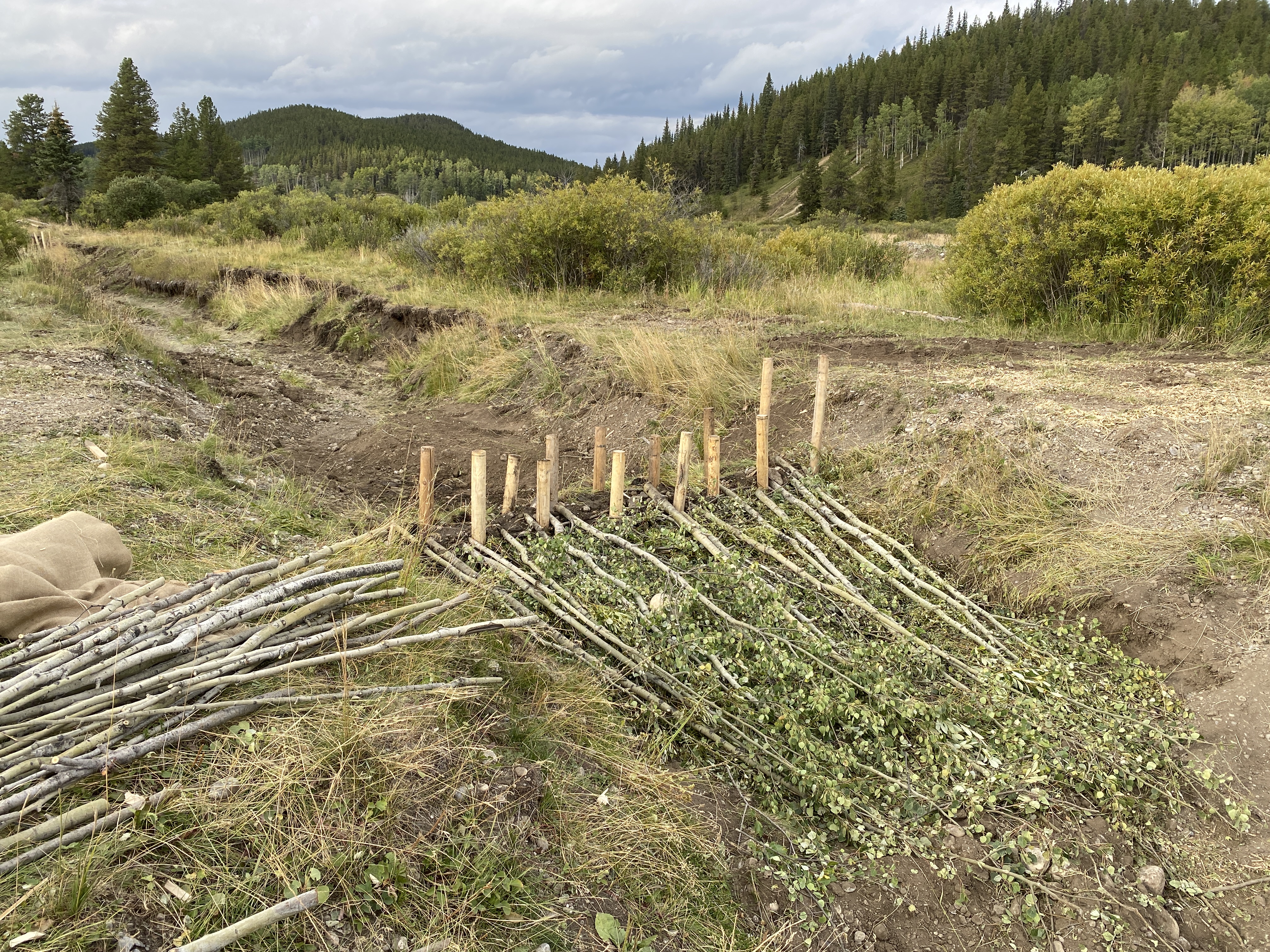
Each of the structures are composed of approximately 15 untreated wooden fence posts with a 10 cm diameter and 2.4 m length. The posts are installed every 0.5 m across the channel from one bank to the other. The posts are embedded to a depth of ≥1 m below the streambed. The posts were staggered to allow the placement of material in between. The material placed between the posts includes a cobble layer 20 cm deep and extending 1.3 m upstream and 2.1 m downstream. The next layer of material is woven native vegetation such as willow, poplar, dogwood, and aspen. This layer functions as the crest of the structure and extends for 60 cm above the streambed. Posts extend 15 cm past the top of the woven vegetation layer. Installation methods were conducted by using a gas-powered post pounder to install the posts into the ground. Cobble and vegetation material was placed in and around the structure by hand. Native bed and bank material such as gravels, fines, and organic material were used to fill in voids between the woven deciduous layer and to enhance the structures water retention ability. By 2024 the BDAs were successfully retaining water within the west Whispering Pines Tributary, successfully raising the water level and providing water for fish species including Bull Trout, Westslope Cutthroat Trout, and Long Nose Dace within the lower portions of the creek. Additionally, in 2023 beavers moved into the west tributary upstream of the BDA, constructing a lodge and two new dams.
Project Photos
Cover Photo
2022-09-06
FInished BDA constructed on the whispering pines west tributary
2022-09-06
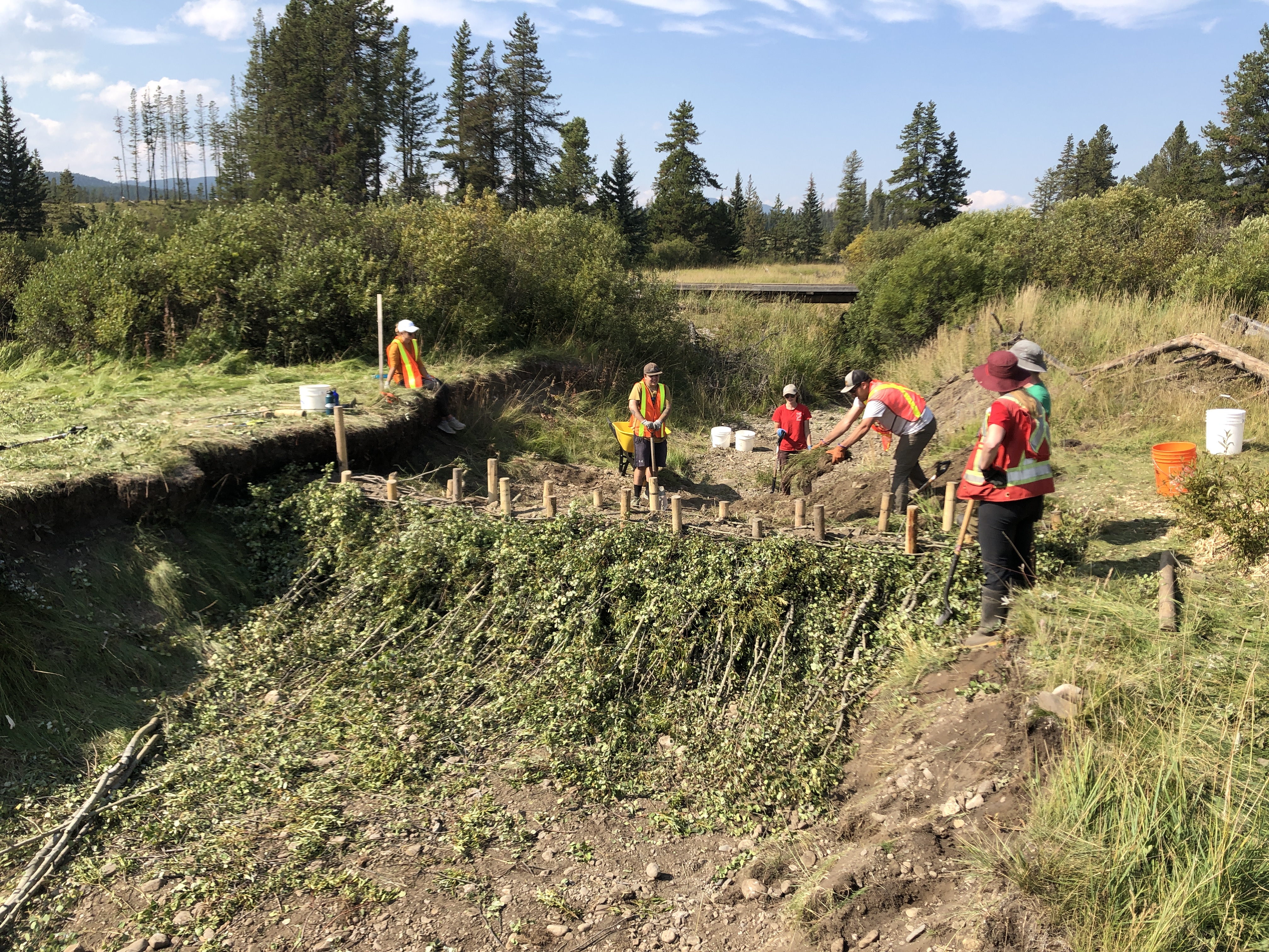
BDA Installation at the West Tributary of Whispering Pines

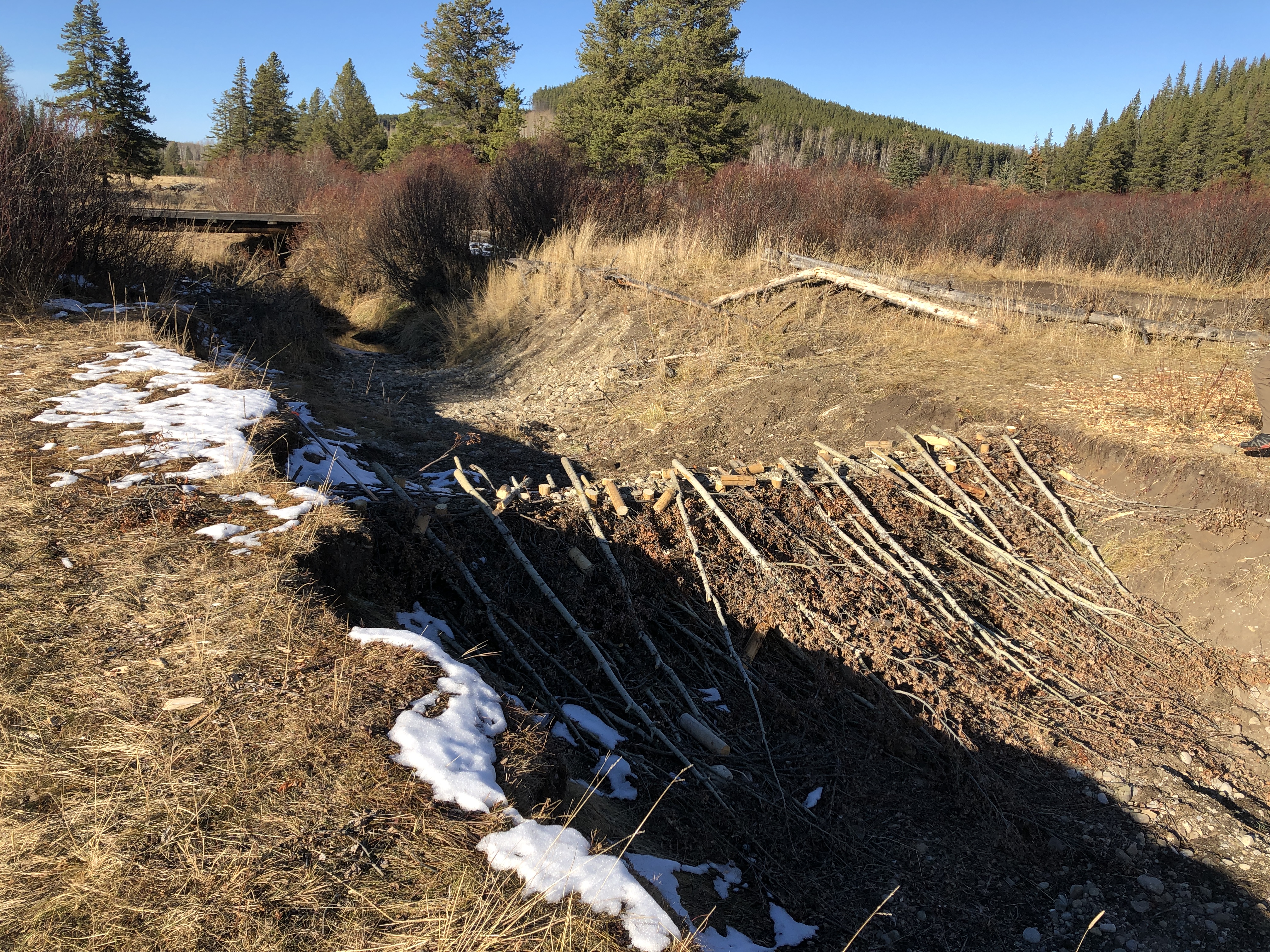
2024-05-09
BDA on the whispering pines west tributary in May 2024
%20(9).JPG)
2024-06-15
Beavers returned to the area and have now built dams and a lodge upstream from the BDA construction area. First evidence observed of the beavers was in September 2022.
%20(25).JPG)
2024-06-15
The lower reach of the treatment area still runs dry in June. Willow stakes likely need higher water table for success.
%20(39).JPG)
2024-06-15
Lots of water being held by top beaver dam Analog in treatment area. while the lower half runs dry.